
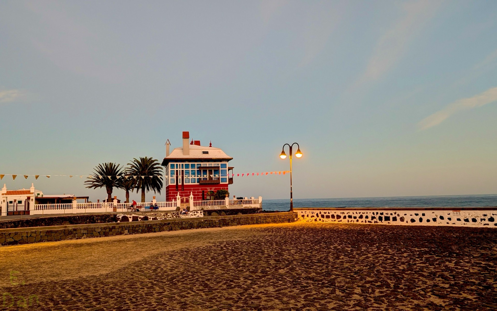
Casa Juanita
← Previous photo: Church of Nuestra Señora de Guadalupe Next photo: Las Grietas →
All 30 photos in Lanzarote & Fuerteventura 2025
Volcanoes, vineyards in the lava and dunes · Jan 2025 · 30 photos
Early January on Lanzarote: mild air, clear skies, a breeze off the ocean and long sunsets in orange and pink. The island in the northeast of the Canary archipelago has a landscape shaped by volcanoes, and a large part of its southwest was buried under lava in the eruptions of 1730–1736. The whole island has been a UNESCO Biosphere Reserve since 1993.
The route sets out from Arrecife, the island’s capital, where the 16th-century Castillo de San Gabriel sits on an islet linked to the town by the Puente de las Bolas. Toward evening, the road passes through Teguise, the former capital, with the church of Nuestra Señora de Guadalupe, and then heads down to Arrieta, on the northeast coast.
Arrecife
The bridge with two pillars topped by stone balls, over clear water, and the walls of the fortress, with the town along the shore.

Puente de las Bolas, Arrecife, Spain 
Castillo de San Gabriel, Arrecife, Spain
Teguise
The volcanic stone bell tower in the last light, with palms and white houses around the square.

Church of Nuestra Señora de Guadalupe, Teguise, Spain 
Church of Nuestra Señora de Guadalupe, Teguise, Spain
Arrieta
Casa Juanita, a red house with a pointed roof by the sea, with palms beside it and the calm ocean at dusk.

Casa Juanita, Arrieta, Spain
Las Grietas are cracks carved by wind and water into volcanic rock. In the afternoon, the route reaches the north of the island, at the Mirador del Río, the viewpoint designed by César Manrique on the edge of the cliffs above the El Río strait. The road then heads down to the south of the island, to Playa de Papagayo.
Las Grietas
Walls of layered rock, like stacked sheets, and a narrow passage between them, open to the sky.

Las Grietas, Tías, Spain 
Las Grietas, Tías, Spain
Mirador del Río
The island of La Graciosa and its volcanic cones across the water of the strait, and the beach below.

La Graciosa, Haría, Spain
Playa de Papagayo
The cove of golden sand, closed off by a dark cliff, with turquoise water and lava rocks at its mouth.

Playa de Papagayo, Yaiza, Spain
At sunset, the road leads to the Famara dunes, on the northwest coast. Then the route crosses to Fuerteventura, the second-largest island in the archipelago and also a biosphere reserve. On its southeast coast, at Playa de Sotavento, the sea fills a wide lagoon at high tide, next to the hamlet of Risco del Paso.
Famara dunes
Wind-rippled sand, a lifeguard tower, the sun sinking through the clouds and the cliff behind lit by the last rays.

Famara dunes, Teguise, Spain 
Famara dunes, Teguise, Spain 
Famara dunes, Teguise, Spain 
Famara dunes, Teguise, Spain
Playa de Sotavento
Dunes of pale sand, a long beach facing the open sea, the water of the lagoon and the hamlet’s houses below a bare hill.

Playa de Sotavento, Risco del Paso, Spain 
Playa de Sotavento, Risco del Paso, Spain 
Playa de Sotavento, Risco del Paso, Spain 
Sotavento lagoon, Risco del Paso, Spain 
Sotavento lagoon, Risco del Paso, Spain 
Sotavento lagoon, Risco del Paso, Spain 
Sotavento lagoon, Risco del Paso, Spain
Back on Lanzarote, the route comes to the landscape the island is known for. In La Geria, each vine grows in a pit dug into the layer of lapilli, sheltered from the wind. Next door, Timanfaya National Park, established in 1974, protects the land laid waste by the eruptions of some three centuries ago, still almost bare of vegetation. In the evening, the journey ends at Puerto del Carmen, on the southeast coast.
La Geria
Black pits ringed by semicircular stone walls, red volcanic cones behind them and a dirt track leading to a volcano.

La Geria, Yaiza, Spain 
La Geria, Yaiza, Spain 
La Geria, Yaiza, Spain 
La Geria, Yaiza, Spain
Timanfaya
Jagged lava, a cone with a rock arch, and red and black craters stretching toward the ocean.

Timanfaya, Tinajo, Spain 
Timanfaya, Yaiza, Spain 
Timanfaya, Yaiza, Spain 
Timanfaya, Yaiza, Spain
Puerto del Carmen
Red and orange clouds at sunset above a dark mountain across the water, and lava rocks in the foreground.

Puerto del Carmen, Spain 
Puerto del Carmen, Spain